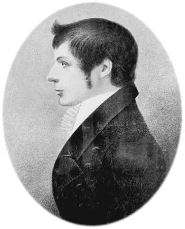
The story of Australia’s expansion is not just about famous captains or royal decrees. It also tells of men with chains and theodolites who went into the bush and measured what happened next. John Oxley was one of these men. He didn’t just draw maps. He helped make the eastern edge of the continent usable for the British Empire.
Born in Yorkshire around 1783 or 1785, Oxley began life far from the Australian sun. He joined the British Navy in 1799. In 1802 he was the master’s mate in Sydney. The transition from naval officer to colonial surveyor was not smooth. It was chaotic. But it was necessary.
From Navy Midshipman to colonial surveyor
Oxley’s early years in Australia were dominated by the sea. He wasn’t just on board. He worked on coastal surveys and mapped the dangerous coastline where ships could run aground. In 1805 Governor Philip King gave him command of the Buffalo. This was no small role. This meant that Oxley was responsible for transporting people and goods in rough waters.
The next year he went to Van Diemen’s Land on another ship. This place later became Tasmania. It was cold, wet and isolated. Oxley saw its potential early on. In 1809, he wrote a report on how to settle it. Then he returned to England.
Why did he come back? get commissioned as a lieutenant. A formal grade. stamp of authority. He returned to Sydney in 1808. He brought goods for investment. He also received a land grant. Six hundred acres. That’s 240 hectares of land waiting for someone to figure out what to do with it.
Burden of Surveyor General
Oxley retired from the Navy in 1812. He became Surveyor General of New South Wales. This title meant that he had the official authority to determine the boundaries of the colony. But he didn’t sit in the office. He went back into the bush.
He explored the Lachlan River area in 1817. His partner was George Evans. They could not find the source of the river. They didn’t find the sea either. They found land. Spacious, open and seemingly endless.
In 1818 Oxley chose the Macquarie River route. No source again. No miracle. But again: country. Good country. A land that sheep love. The type of land that makes sheep farming profitable. The British Empire didn’t need gold right away. It needed wool. Oxley’s research opened wide areas for sheep farming. He turned mystery into pasture.
The book that changed everything
Oxley didn’t just walk. He wrote. His book Two Expeditions into the Interior of New South Wales appeared in 1820. It was the first true description of the area he had mapped. explorers guessed. Oxley presented the facts. Distances. Soil quality. Water sources.
This book became a blueprint. Charles Sturt used it. T. L. Mitchell used it. These men went
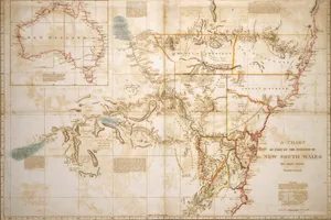
The maps he drew weren’t just on the shelves. They dictated where people went, suffered and built.
After charting the treacherous coastline from Jervis Bay to Port Macquarie in 1819, Oxley turned his sights inland. In 1823, just after returning from Port Curtis, he arrived at Moreton Bay. He didn’t stop at the bank. He traveled 50 miles (80 km) up the Brisbane River, testing its depth, potential and limits.
The result was cold and administrative. His reports became blueprints for penal settlements. Port Macquarie was named. Port Curtis followed. The land was not explored for its beauty. It was surveyed for containment.
From Explorer to Entrepreneur
The man who drew the lines had to live by them.
When the Surveyor-General returned to Sydney in 1812, he exchanged sea for land. His hands, once on sextants and chains, now managed ledgers. He became an intermediary for companies and creditors. He raised cattle. He raised prize-winning sheep and treating livestock with the same precision he applied to topography.
He sat on the bank’s boards. He advised in agriculture. He was no longer just a government employee; he was a pillar of the colonial economy.
In 1815 he built Kirkham on his enlarged property. It was a legacy, a sign of permanence. He believed in the stability of the land.
The Public Servant’s Burden
Oxley did not retreat into private wealth. He entered public life with the same tireless energy.
He was active in the Bible Society. He supported orphanages. He served in the Philosophical Society. He was a judge. He was a legislator.
He tried to build a society that matched the order of his maps. Clear lines. Clear rules. Defined boundaries.
It didn’t work that way.
History often remembers the discoverers, not the administrators. Oxley died in straitened circumstances.
His charted penal settlements survived for decades. The sheep he raised won awards. Kirkham’s estate remained. But the man himself? In the end he had less than at the beginning.
The maps held up. The man did not.
Why do we remember the lines but forget the hand that held the pen?
The land remains. Settlements were renamed or abandoned. The banks he led survived his bankruptcy. But Oxley’s name is now just a footnote in the stories of those who followed him.
A surveyor measures the world. He doesn’t control it.