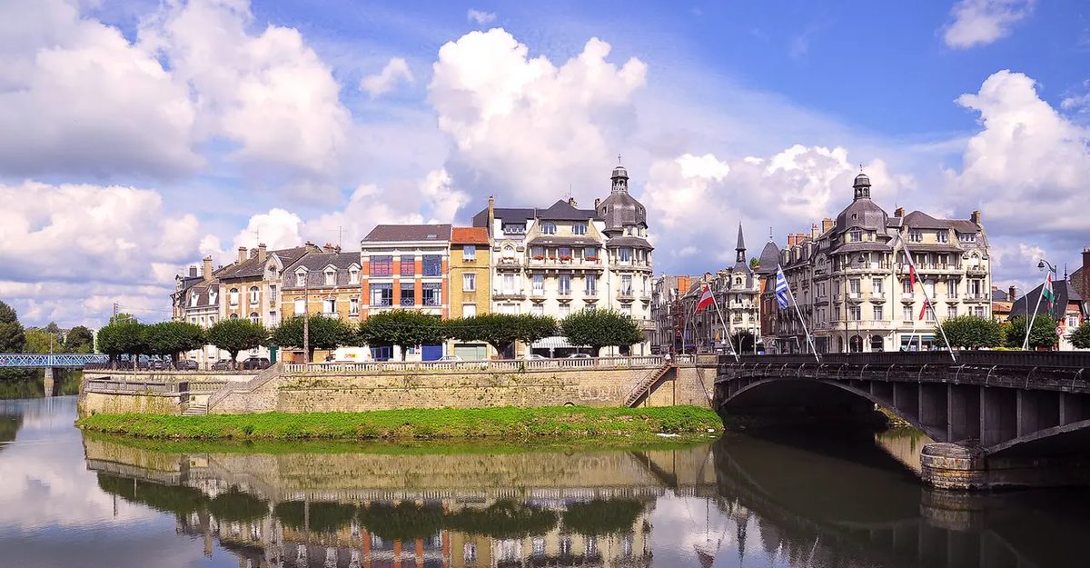
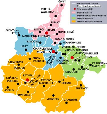
The Ardennes department sits in the Champagne region of France today. But if you look at a map and wonder why its borders don’t match the historical province of Champagne, you are not alone. The answer isn’t geographic convenience. It is administrative chaos from the French Revolution.
A Patchwork of Power
When the revolutionaries redrawn France’s map, they didn’t care about old feudal lines. They created departments to break the power of local nobility. The Ardennes emerged from a messy collection of territories. It wasn’t a single coherent area. It was a grab bag.
The new department pulled in parts of the old Province of Champagne. But it also snatched up pieces of the Argonne forest region. That was a separate cultural and geographic zone. The creators didn’t stop there. They added small principalities. Arches and Sedan were independent enough to be noticed. They got folded in.
Then came the counties. Rethel was attached to the mix. These weren’t just random villages. They were distinct political entities with their own laws and loyalties. Sticking them together created a department with an internal identity crisis.
The Spanish Connection
There is another layer to this historical mess. The Ardennes also absorbed territories from the Spanish Netherlands. These lands stayed separate from France for a long time. They only joined the French state in the 18th century. This added a different linguistic and cultural texture to the department. You had French-speakingChampagne roots mixed with older Spanish-controlled borders.
So the Ardennes isn’t just a piece of Champagne. It is a hybrid. It carries the weight of multiple historical identities. The department created during the Revolution wasn’t built on geography. It was built on political necessity.
Why It Matters Now
This history explains why the Ardennes feels different. It is not just a rural area in Champagne. It is a borderland. Historically, it sat between France and the Low Countries. That position made it a buffer zone. Now it is a department with a complex past. Understanding this helps explain its current economic and cultural ties. The borders are arbitrary. The history is not.
The Borderlines That Never Settled
It was 1793. The map shifted again. The Ardennes department swallowed the bailiwick of Couvin and the Imperial county of Fagnolle. Then came 1795. The Duchy of Bouillon joined the mix.
Borders are never static. They are temporary agreements written in blood or bureaucracy.
By 1815, the reverse happened. The territory shrank. Bouillon, Couvin, Mariembourg, Fagnolle, and Philippeville were stripped away. It sounds like a game of musical chairs played by empires. The region’s genesis is messy. It is complicated. But through all the expansion and contraction, one thing remains constant.
The Ardennes department belongs to a larger entity. A vast, ancient forested region known simply as Ardenne or Les Ardennes.
Geographically speaking, defining the Ardennes requires looking at it as a vast forested territory with specific borders. It isn’t just a vague region; it has hard edges.
To the south, the area meets Lorraine and Champagne. These are distinct French regions with their own histories, but they form the southern limit of this specific forest zone.
To the west and north, the water defines the edge. The Sambre and Meuse rivers act as natural barriers. If you cross those waterways, you are leaving the core Ardennes landscape.
To the east, the terrain shifts dramatically. The border is marked by the volcanic Eifel region. This geological shift signals the end of the Ardennes plateau and the beginning of a different volcanic landscape.
Which countries make up the Ardennes?
Most of this territory sits in Wallonia, the French-speaking region of Belgium. This is the heartland.
In France, the Ardennes covers parts of two departments: Ardennes and Meuse. These names might seem obvious, but they align with the historical and geographical spread.
It also spills into the Grand Duchy of Luxembourg. The region doesn’t respect modern political lines. It’s a continuous landscape that spans across these three nations.
This isn’t just about maps. Knowing where it is helps you understand its culture. The shared geography created a shared way of life. Forests, rivers, and mountains don’t care about borders. They shape the people who live there regardless of which side of the line you are on.
The High Ground: Where Climate and Coal Collided
694 meters. That is the peak at Signal de Botrange, sitting pretty in the Hautes-Fagnes of Liège province. It is the highest point in L’Ardenne, but looking at the map, you would not guess why people stayed here.
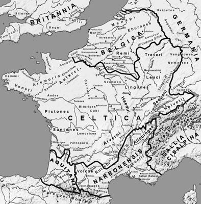
The first regular footprints date back to the 5th century BC. The Celts were moving in. Expansion. But growth? Slow. Painfully slow.
Why? Look at the terrain. The climate bites. The rivers are difficult—except for the Moselle and the Meuse, which actually help. The rest? Just landes. Peat bogs called fagnes. Hard to walk on. Hard to build on.
The region’s isolation was its first defining feature, broken only by necessity and then by industry.
Fast forward to the 18th century. The forest was already being chewed up. Construction. Fuel for heating (affouage). Clearing land (essartage). And grazing. But the big one? Charcoal. For the forges.
They needed wood to burn to make metal. The trees came down. The landscape changed.
Then came the 19th century. This is where the story shifts from survival to industry. L’Ardenne became one of Europe’s first hotspots for metallurgy. The isolation vanished.
Railways cut through the hills. Suddenly, you could move heavy stuff. But there was a catch. Mines needed timber to shore up the galleries. So, they planted spruce trees. Not for beauty. For structural support deep underground.
The region transformed. From a boggy, cold outlier to an industrial engine. The trees that once shaded Celts now held up the shafts that fed the furnaces.
The geology of the Ardennes is a story written in stone, and it is a dense one. You have to look past the forests to see the bones of the earth. This isn’t just dirt. It’s the Variscan orogeny, a mountain-building event so ancient it reshaped the continent. The rock here is primarily slate. Dark, layered, stubborn slate.
But it’s not all grey and black. There are pockets of limestone, too. And buried in those layers are fossils. They are the silent witnesses to a time when this land was an ocean floor. You can still find them if you know where to look.
Then there is Sedan.
It sits on top of all this history, but it feels like a different world entirely. The Château de Sedan dominates the landscape. It is widely considered the largest fortified castle in France. The size alone is enough to make you stop walking and just stare. It doesn’t just sit on the hill. It clings to it. The ramparts curve around the town below, a defensive wall that once kept armies out and kept the Prince of Sedan safe.
Why does the geology matter when you’re standing in the shadow of that massive stone structure? Because the stone in the walls and the rock in the ground are part of the same narrative. The slate from the hills provided the material. The limestone from the valleys provided the foundation. The geography dictated the strategy. A castle doesn’t appear in a vacuum. It appears where the land allows it to stand tallest and strongest.
The contrast is what stays with you. The deep, slow pressure of tectonic plates versus the sudden, aggressive projection of military power. One took millions of years. The other took months to build and decades to defend.
Walking through the grounds at Sedan, you can feel the weight of both. The rock beneath your feet is older than the concept of France. The stone around you is older than the idea of borders. They coexist here, quiet and heavy, while the rest of the world moves on above them.